A new documentary, Drawn to Victory, tells how innovative mapping techniques used during the First World War helped turn the tide. This story, part of a collaboration with the film’s producers, explores how those advances triggered an explosion in detailed maps of Canada
“I must call your attention to the immense strides in mapping which are being made possible by the use of aerial photography. Our operations this year are resulting in the placing upon maps thousands of lakes and islands, and the filling in of immense gaps occurring on present maps … All features of importance, both large and small can be shown, and the maps will be complete in detail.” — Athol Narraway, Federal Controller of Surveys, Topographical Survey of Canada, 1924
CANADA WAS A COUNTRY WITH few pilots, let alone an air force, when it entered the First World War in 1914. Yet more than 22,000 Canadians wound up serving in the ranks of the British flying squadrons by the time the Armistice was signed in November 1918, including 1,388 who were killed in action.
Many airmen — including the likes of fighter pilots William Barker, Canada’s most-decorated soldier, and Billy Bishop, whose 72 victories led all Canadian flyers — started as soldiers in the Canadian Expeditionary Force before transferring to the Royal Flying Corps or Royal Air Force. But thousands more were sent directly for air duty after being trained in flying schools and bases in the U.K., the U.S. and on home soil.
From early 1917 on, an important part of that training included aerial surveying and photography. Anyone familiar with the Battle of Vimy Ridge story will realize that maps made from air photos were essential to the planning and execution of most manoeuvres, culminating in the creeping artillery barrage that secured the Canadian win.
In the air, that translated into the pioneering efforts of pilots and photographers with fighter pilot escorts, braving attack from German aircraft and ground fire to capture accurate photos of troop movements, trenches and artillery positions behind enemy lines. On the ground, it took hundreds of personnel in topographical units using the imagery to develop new technologies and methods to produce up-to-date maps for use by generals and foot soldiers alike.
When the war ended and these veterans returned home, Canada was awash in mapping and photography and flying expertise. It’s hard to imagine a better situation for a vast land that was sparsely settled, little explored by any but First Nations and Inuit, and still mostly unmapped.
The job would take decades, but it was within the first five or six years after the First World War that the people, organizations and expertise reached a critical mass and the ultimate goal took shape — capturing the entire country on a map. It’s a story of heavy toil, triumph and tragedy, involving airmen, politicians, bureaucrats and surveyors; new planes, new cameras and new ways of exploring the Canadian wilderness. (Significantly, it also paralleled the Group of Seven’s rise to prominence for their artistic exploration of Canada’s North.) For Gord Beck, keeper of the paper map archive at McMaster University’s Mills Memorial Library, it’s nothing less than the story of a country and a national identity in the making. “In order to bring the country together you’ve got to map it and find out what’s there,” he says. “They acted very quickly after the war ended.”
In fact, officials at home began to study civilian applications for aerial photography even before the war was done. By mid-1919, that task had been taken up by a federal interdepartmental committee led by Canada’s long-standing Surveyor General, Édouard-Gaston Deville, a pioneer in the field of photo-topography (mapmaking with the aid of photography) using elevated cameras sited on mountains and hilltops.
The same year, after Canada received a “war gift” from the British government consisting of about 100 surplus planes from different makers, aerial cameras, vehicles and other gear, and a dozen Curtiss HS-2L “flying boats” from the U.S. Navy, Ottawa established the Air Board, Canada’s first governing body for aviation. The first Canadian Air Force was also created by early 1920, and began a program to use planes for forestry patrols and to explore and survey remote areas, while also test- ing cameras (plate- and film-based) and aerial photography techniques. People knew they were on to something, but its true magnitude still wasn’t clear.
WHILE THE GOVERNMENT PLANNED its next steps, there was more of a mad dash to the air in the private sector. In photography and mapping, private operators got the jump on the government in 1919 with two forest surveys, on the Labrador coast and in Quebec. The latter, in particular, heralded a surge in private flying activity, and was indicative of the nature of all early attempts at aerial surveying and photography in Canada.
The plan began with Ellwood Wilson, chief forester of the Laurentide Co. Ltd., one of the local paper companies in the St. Maurice Forest Protective Association based in Quebec’s St. Maurice River valley, north of Trois-Rivières. Wilson, an early proponent of aerial surveying, had secured for the association’s surveys the loan of two of the HS-2L flying boats that had just been gifted to Canada. The federal government, which had not yet begun to deploy the aircraft, agreed in exchange for full reports on their use.
The HS-2L was an early seaplane designed for bombing submarines, all wings, wires and a big fan engine mounted behind the cockpit on an open body shaped like a boat hull. It was also underpowered, hard to control and prone to engine trouble. Still, the HS-2L’s first demo flight for the association was also the first aerial photographic survey in the country, even though it took some customizing of the plane to make it happen — including cutting a hole in the bow through which a mount for a waterproof camera was installed for vertical shooting. After some experimentation, pilot Stuart Graham, an RAF veteran, and his engineer managed to take 100 photographs along a 100-kilometre track at 1,500 metres.
Although the accuracy and detail of the photography exceeded expectations, the costs of running an airplane led all but one of the Mauricie association’s companies to take a pass on any long-term commitments. The exception was Laurentide, which saw value in using the aircraft for fire patrol and transport, as well as photography and mapping, and the two planes, still on loan from the Air Board, were turned over to the paper company. In 1921-22, it spun off the flying business into Laurentide Air Services, and of the 20 or so private flying ventures that launched in the early 1920s, it was, for a short time, the biggest. Laurentide got big by doing a lot of work on contract for the Ontario government — until 1924, when the province created the Ontario Provincial Air Service and brought its flying work in-house. Laurentide was soon no more, its disappearance part of a shakeout that left just a handful of private flyers in business by mid-decade.
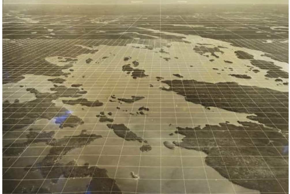
ONE OF THE MOST IMPORTANT technical advances marrying aerial photography to map-making in the First World War was the creation of mosaics. Mosaics get you from pictures to maps. Making them requires piecing together a series of overlapping vertical angle photographs of the ground below like a puzzle. From those, cartographers extract base data — distances, elevation, significant features — to create accurate topographic maps.
The main challenge of mosaics lay in developing measurement techniques that accounted for distortion and methods for reconciling inconsistencies from photo to photo due to changing positions of the plane. Pilots were supposed to fly a straight line at a fixed height and camera operators to shoot at regular distance intervals. But that was a difficult task in such primitive aircraft in the face of enemy fire. Overcoming these factors to make accurate maps, at different scales, was a technical and tactical breakthrough.
So when the federal Air Board’s program started in 1920, it was no coincidence that its first experimental task was to create a mosaic, with photos taken that summer over Ottawa-Hull. Surveyor General Deville supervised, appointing Dominion land surveyor and phototopography expert Howard Lambart as project manager at the new Rockcliffe airfield/air harbour on the Ottawa River. Could they factor out all the variability between photos and get them to line up? If yes, they could make maps. If not, it was back to the theodolite (a small tripod-mounted telescope used in surveying).
Testing started with two different planes, an Avro and a Bristol, and an ex-RAF semi-automatic plate camera, all war gifts from Britain. The Avro couldn’t climb high enough and shook badly; the Bristol had hair-trigger controls that made straight and level flying near impossible. But at the end of the season, Lambart and his team successfully “rectified” the photos they’d taken to create a mosaic. According to Don Thomson’s account in Skyview Canada, the Air Board’s published report on the work “created a considerable stir in engineering circles in Canada and outside this country.”
Rockcliffe was one of five bases that the Air Board opened across Canada in 1920. The others were at Dartmouth, N.S.; Roberval, on Lac St. Jean, Que.; Jericho Beach, B.C.; and Morley, Alta. To help outfit them, the 10 remaining U.S. Navy HS-2Ls were taken out of storage, reassembled and distributed among the seaplane bases, with one also going to Victoria Beach on Lake Winnipeg, where the Air Board opened a sixth base in 1921.
Ottawa was earmarked specifically for research and testing. There, over the next couple of years, they tested different planes, cameras, mounting techniques and wireless communications equipment. Research also continued in the map-making department. While mosaics worked for vertical photographs, there was no proven method for transferring information from oblique angle photographs shot toward the horizon out the sides of planes. In 1922, one of Deville’s surveyors, R.B. McKay, devised a process using perspective grids on photos from which maps could be drawn by square-to-square plotting. He then went one better, turning this method into a system for map- ping large tracts of land by standardizing the angle of tilt in the oblique photos being shot. Finally, he designed a set of pre-etched overlays that could be used to determine quickly the right grid for every photo. McKay’s system soon had a name: the Canadian Method.
FORMER FIRST WORLD WAR PILOTS headed many of the Air Board’s bases. At Jericho Beach, that was Maj. Claire MacLaurin, a distinguished Royal Naval Air Service and RAF flyer, originally trained in Toronto’s first flying school in 1915. As with most of the bases, Jericho’s growing workload was split between regular patrols and custom photographic and surveying assignments for things like geology and mineral identification, study of potential hydroelectric sources, farmland, park planning and so on. There were also occasional flights with senior surveying staff and visiting bureaucrats, who would invariably return raving about the aerial photography’s potential versus land-based surveying. According to Jeffrey Murray, author of Terra Nostra: The Stories Behind Canada’s Maps, 1550-1950, and a retired Library and Archives Canada map archivist, “they could see that trying to map the thousands [of features] below individually from the ground would take a lifetime. Whereas flying over them and photographing they could do in a single season.”
Despite the growing workaday regularity, however, this was still frontier flying with aging, unreliable aircraft. And in 1922, that reality caught up with MacLaurin, as he and a project engineer passenger crashed and died attempting an emergency landing after a fuel leak in one of Jericho’s HS-2Ls.
If crashes and fatalities were commonplace, breakdowns were even more frequent. Yet demand for flying — and for aerial photography and mapping, in particular — kept growing. To maintain control and keep its costs in order, the Air Board created new rules to funnel all federal department photography requests through the Topographical Survey Branch of the Department of the Interior. Bit by bit, the air photo bureaucracy was coming together. As S. Bernard Shaw writes in Photographing Canada from Flying Canoes, “Emerging by this time was the idea that all of Canada could be accurately mapped from aerial photography.”
Organizational change was afoot at all levels. Prime Minister Mackenzie King’s Liberals hadn’t been in office long when in 1922 they announced the creation of the Department of National Defence. The Air Board was absorbed, while the Canadian Air Force, which had been created in 1920 as a non- permanent air militia under the Air Board, was remade under DND, and took responsibility for all flying in Canada. Times were tight, but the government still found enough money in 1923 to allocate $250,000 for new waterborne aircraft. It knew the CAF fleet of wartime castoffs was holding work back and a safety risk, but it had its own motive, as well: to restart a domestic aircraft manufacturing business. So it issued a tender for eight new single-engine flying boats on the condition that they would be made in Canada.
The winner was Canadian Vickers Ltd., of Montreal, a branch plant of Vickers of the U.K. While it did mostly ship work, the company had experience assembling and repairing planes and, best of all, offered the Vickers Viking, a next-generation flying boat that met the CAF’s technical specs — able to work at a minimum 80 mph (130 km/h) for at least six hours at a ceiling of 12,000 feet (3,650 metres) and carry a pilot and four crewmen. The Vikings were delivered quickly. While they didn’t transform the air force fleet overnight, they proved to be workhorse photo planes and personnel carriers and helped it grow. Their arrival also coincided with a photographic technology turnover. In 1923, DND bought its first U.S.-made Fairchild camera and after testing, Fairchild models — with better lenses, shutter and aperture designs, automatic film advance and automated shutter settings — became go-to cameras for a decade.
BASIL HOBBS WON ACCLAIM in the Royal Naval Air Service for sinking German submarines and taking down a zeppelin, and stands tall as Canada’s second-most decorated pilot. He’s also enshrined in the Canadian Aviation Hall of Fame. But perhaps unexpectedly, he’s heralded not as much for those feats as for one that took place after the war while he was commander at the Royal Canadian Air Force’s Victoria Beach base on Lake Winnipeg.
The year was 1924. And it was already set to go down as a breakout year for aerial photography and the mapping of Canada. The torch from the First World War had been passed. New aircraft and equipment were in place, methods refined, people trained and the value, need and possibilities well enough understood. But Hobbs and three crew members put an exclamation point on it when they undertook a 4,500-kilometre, 29-day photography assignment over the Churchill River watershed and Reindeer Lake in northern Manitoba and Saskatchewan. Reviewing it in his year-end report, Athol Narraway, federal controller of surveys at the Topographical Survey, called it “one of the most brilliant achievements in the history of flying.”
The trip, split over July and August, involved 44 hours and 10 minutes air time. Petty Officer James Cairns took 1,700 photographs. The Dominion Survey’s Robert Davidson was navigator and Cpl. Alexander Milne the mechanic. They flew in a Viking aircraft from Victoria Beach, Man., used a new Fairchild camera and proved beyond any doubt that photographic flights could penetrate and capture the interior and the North.
It was almost a foregone conclusion, then, when the government subsequently instructed the RCAF and the Topographical Survey Branch to get together on a plan to systematically photograph the country. Prior to that year, aerial cameras had captured less than 10,000 square kilometres of Canada. In 1924 alone, RCAF photographers added more than 100,000 square kilometres to the total. There would be no turning back.
This article was originally published in the Sept.-Oct. 2015 issue of Canadian Geographic magazine